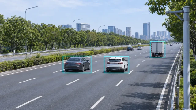
A stopped vehicle in a live traffic lane can create a serious secondary-collision risk. Wrong-way movement, sudden congestion, abnormal lane changes and objects entering restricted road areas can also require a rapid response from traffic operators.
Traffic incident detection radar helps monitor these situations by continuously measuring the position and movement of road users. Unlike a simple point detector that records a vehicle only when it crosses a fixed location, a tracking radar can observe how multiple targets move through a defined section of road.
However, radar does not independently “understand” every incident. The radar supplies detections, target tracks and traffic parameters. Event-processing software then applies rules to determine whether a stopped vehicle, queue, wrong-way movement or other abnormal condition may have occurred.
Understanding this distinction is essential when designing an automatic incident detection system.
What Is Traffic Incident Detection Radar?
Traffic incident detection radar is a roadside sensing system that uses radar measurements and target-tracking algorithms to monitor vehicles or other detectable road users over time.
Depending on the sensor and system configuration, the output may include:
- Target ID
- Longitudinal and lateral position
- Vehicle speed
- Direction of travel
- Lane assignment
- Target trajectory
- Object classification
- Lane-level vehicle count
- Average speed
- Occupancy
- Queue or headway information
The incident-detection application analyses this information against configured road zones and event rules.
For example, a tracked target remaining almost stationary inside a live lane for longer than a specified time may generate a stopped-vehicle candidate. The system can then send an alert to a traffic management platform for verification and response.
Radar Detection Versus Incident Detection
A radar sensor detects reflected signals and estimates target parameters. An incident-detection system interprets those target parameters in the context of the road.
This process contains several layers:
- Radar measurement
- Detection and clustering
- Multi-object tracking
- Lane and road-coordinate mapping
- Event-rule evaluation
- Alert generation
- Operator or system response
An error in any layer can affect the final result.
A valid radar target may still be assigned to the wrong lane if the road geometry is configured incorrectly. A correctly tracked stopped vehicle may not generate an alarm if the stopping-time threshold is too long. Conversely, a very short threshold may create alerts for vehicles waiting normally in congestion.
The incident logic must therefore be designed around the actual road and operating environment.
How the Detection Process Works
1. Radar Measures Road Users
The radar observes targets within its field of view and measures parameters such as range, radial velocity and angle.
Tracking algorithms connect measurements across consecutive updates to create stable vehicle trajectories. A track may continue briefly through missed detections or partial occlusion.
For more detail, see our guide to radar object tracking.
2. Tracks Are Mapped to the Road
The system converts radar coordinates into a road-coordinate model containing:
- Traffic lanes
- Shoulders
- Medians
- Entry and exit areas
- Monitoring zones
- Exclusion zones
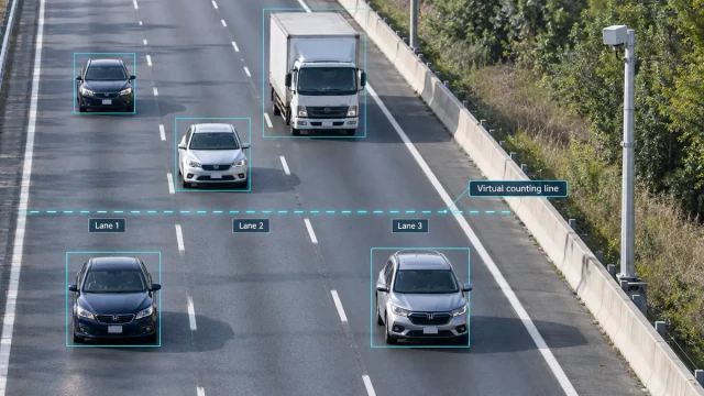
- Virtual detection lines
Correct sensor alignment and lane mapping are critical. A small angular error at the radar can become a significant lateral-position error at long range.
3. Event Rules Analyse Target Behaviour
The application evaluates each target or traffic stream according to configured conditions.
Rules may examine:
- Target speed
- Direction of movement
- Time spent inside a zone
- Distance travelled
- Lane position
- Changes in speed
- Traffic density
- Average lane speed
- Relationships between nearby targets
A possible event becomes an alert only when its conditions remain valid for the required confirmation time.
4. Alerts Are Sent to the Traffic Platform
Once confirmed, the event can be transmitted to a traffic management centre, roadside controller or related safety platform.
The receiving system may:
- Notify an operator
- Display the target location
- Open a relevant camera view
- Activate a warning sign
- Request incident verification
- Close a lane through a control workflow
- Dispatch roadside assistance
- Record the event for later analysis
The correct response depends on the road authority and system architecture. Radar detection alone should not be assumed to perform every operational action automatically.
Events a Radar-Based System May Detect
Available event types depend on the radar, tracking quality, road geometry and application software.
Stopped-Vehicle Detection
Stopped-vehicle detection identifies a tracked object that remains below a speed threshold within a monitored lane or zone for a specified duration.
The algorithm normally needs to distinguish an abnormal stop from:
- Congested traffic
- A normal traffic signal queue
- Toll-station activity
- Temporary road works
- Vehicles using a permitted stopping area
- Slow-moving maintenance vehicles
Road zones and confirmation times are therefore configured differently for free-flow highways, tunnels, ramps and urban roads.
A stopped-vehicle alert should include enough information for the traffic system to locate and verify the event.
Wrong-Way Vehicle Detection
A wrong-way event can be detected by comparing the tracked direction of a vehicle with the permitted direction assigned to the lane or road zone.
Reliable detection requires:
- Stable direction estimation
- Correct road-coordinate calibration
- A minimum track length
- Exclusion of reversing or authorised vehicles
- Appropriate confirmation logic
A single noisy direction estimate should not immediately be treated as a confirmed wrong-way vehicle.
Queue and Congestion Detection
Queue detection may use both individual vehicle tracks and aggregated traffic parameters.
Possible indicators include:
- Reduced average lane speed
- Increased occupancy
- Shorter vehicle headway
- More stopped or slow targets
- A queue tail moving upstream
Queue-tail position can be particularly useful for warning systems because fast-approaching vehicles may encounter stationary traffic unexpectedly.
Traffic-flow data can also distinguish a temporary slow vehicle from a broader congestion event.
Abnormal Slow Movement
A vehicle travelling significantly below the normal traffic speed may indicate a mechanical problem, oversized load or other abnormal condition.
The threshold should account for:
- Lane type
- Road speed
- Traffic state
- Road gradient
- Vehicle class
- Weather and work-zone conditions
A fixed universal threshold is unlikely to work well across every road section.
Pedestrian or Vulnerable Road-User Entry
Some radar systems can detect and track pedestrians, cyclists or other vulnerable road users.
Whether this can support a reliable alert depends on:
- Sensor resolution
- Detection range
- Classification capability
- Target visibility
- Roadside clutter
- Required probability of detection
- Acceptable false-alarm level
A specification stating that a radar can detect pedestrians does not automatically prove that it can provide safety-certified pedestrian incident detection at every distance.
Fallen Objects and Road Debris
Large objects may generate radar detections, but small or low-reflectivity debris can be difficult to detect consistently.
Debris detection performance depends heavily on:
- Object dimensions
- Material and radar reflectivity
- Distance
- Mounting angle
- Road surface reflections
- Required detection confidence
Projects requiring debris detection should be validated with representative objects at the actual site. It should not be promised from vehicle-detection specifications alone.
Why FMCW Radar Can Detect Stopped Vehicles
A basic continuous-wave Doppler radar primarily responds to motion. When a target becomes stationary, its Doppler frequency approaches zero, making stationary presence difficult to distinguish from static surroundings.
Frequency-modulated continuous-wave radar can measure range as well as velocity. With suitable signal processing, it can continue to estimate the position of a stationary object.
However, detecting a stationary reflection is only part of stopped-vehicle detection. The system must also distinguish the newly stopped vehicle from permanently static objects such as barriers, signs and roadside structures.
This usually requires background filtering, target history and track-management logic.
Radar Versus Other Incident-Detection Technologies
Radar and Inductive Loops
Inductive loops provide reliable detection at specific road positions but require work in the road surface.
They can supply traffic flow and occupancy information, but a loop does not normally provide a continuous vehicle trajectory across a long road section. Incident-detection algorithms based on loops often infer congestion or abnormal conditions from changes in traffic parameters.
Radar is installed above ground and can monitor targets across a larger area, but requires suitable mounting, alignment and event-processing software.
Radar and Video Detection
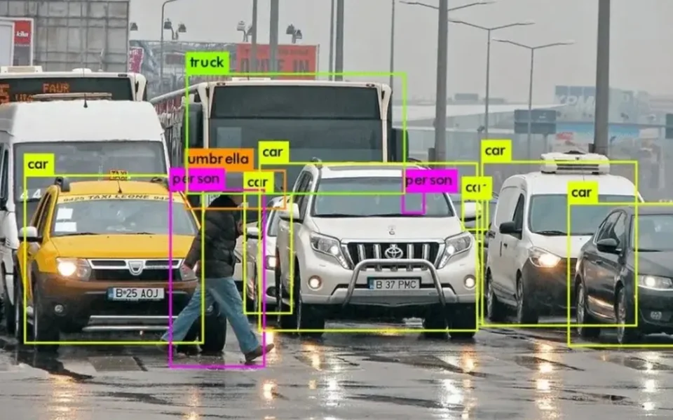
Video provides intuitive visual information and can support detailed classification. It is also useful for operator verification.
Its performance may be affected by:
- Darkness
- Glare
- Shadows
- Fog or heavy precipitation
- Dirty lenses
- Camera movement
- Occlusion
Radar directly measures range and radial speed and does not depend on visible illumination. It can still be affected by multipath, occlusion, road geometry and improper configuration.
The technologies are complementary rather than universally interchangeable.
Radar–Video Fusion
Radar–video fusion can combine radar target measurements with visual information.
Radar can provide:
- Range
- Speed
- Continuous trajectories
- Operation independent of visible illumination
Video can provide:
- Visual confirmation
- Rich appearance information
- Additional object classification
- Images for traffic operators
A fusion system requires coordinate calibration and time synchronisation. Radar targets and image objects must be associated correctly, particularly when several vehicles are close together.
Read more in our guide to radar–video fusion for roadside traffic monitoring.
Common Causes of False or Missed Alerts
Automatic incident detection is a balance between detection sensitivity and false-alarm control.
Congestion
Vehicles repeatedly stopping and moving can resemble a stopped-vehicle event. The system must consider surrounding traffic conditions.
Occlusion
A large vehicle may hide another target from the radar. Mounting position and multi-sensor coverage can reduce, but not universally eliminate, occlusion.
Multipath
Radar signals reflected by barriers, signs or metal structures can create measurements at unexpected apparent positions.
Road Curvature
Targets may move across the sensor’s lane model on a curved road unless the geometry is configured accurately.
Entry and Exit Zones
Vehicles entering ramps, lay-bys or service areas may appear to stop or travel in an unusual direction relative to the main road.
Maintenance and Emergency Vehicles
Authorised vehicles may stop in monitored zones. The operational workflow must account for these activities.
Threshold Configuration
Very sensitive rules increase the probability of alerts but may also increase false alarms. Conservative rules reduce false alarms but can delay or miss events.
Performance Metrics That Matter
A useful incident-detection evaluation should include more than maximum radar range.
Important metrics include:
- Probability of event detection
- False-alarm rate
- Mean time to detect
- Alert latency
- Event-location accuracy
- Track continuity
- Correct lane assignment
- System availability
- Recovery after occlusion
- Performance during congestion
- Performance in adverse site conditions
Detection rate and false-alarm rate must be evaluated together. A system that detects almost everything but produces constant false alerts may be operationally ineffective.
The test plan should define what counts as a true event, which events are excluded and how operator verification is recorded.
Designing a Roadside Incident-Detection System
Define the Events First
Start by listing the required events and expected operational response.
Examples include:
- Stopped vehicle in a live lane
- Wrong-way vehicle
- Queue tail
- Slow vehicle
- Pedestrian entering a restricted road
- Vehicle entering an exclusion zone
Each event needs a clear definition and confirmation rule.
Survey the Road Geometry
Document:
- Lane layout
- Curvature and gradient
- Barriers and signs
- Mounting locations
- Detection distance
- Entry and exit points
- Areas where normal stopping occurs
- Potential sources of occlusion or reflection
Define the Output Interface
Confirm whether the receiving platform needs:
- Raw detections
- Tracked-object lists
- Lane statistics
- Preconfigured alarms
- Event coordinates
- Camera preset commands
- Diagnostic messages
- Sensor health information
Ethernet or RS485 describes only the physical interface. The application protocol and data format must also be confirmed.
Conduct a Field Validation
Testing should reproduce both normal traffic and representative incident scenarios.
It should include:
- Different vehicle sizes
- Multiple lanes
- Dense traffic
- Stop-and-go traffic
- Lane changes
- Temporary target loss
- Day and night operation
- Realistic weather where possible
- Road-maintenance activity
A single isolated-vehicle test is not enough to validate a multi-object incident-detection system.
The Role of HC-M250
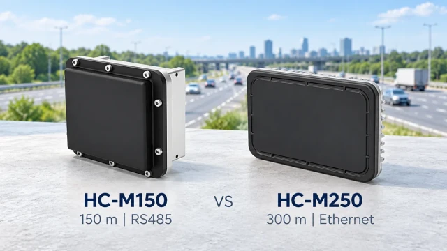
The HC-M250 long-range traffic radar provides target-level vehicle data and lane-based traffic-flow statistics for roadside system integration.
Its current configuration supports:
- Detection distance up to 300 metres
- Coverage of up to eight lanes
- Tracking of up to 128 targets
- 70 ms update cycle
- Vehicle position and speed output
- Lane-level traffic statistics
- Ethernet communication
These outputs can serve as input to an incident-detection platform. The application layer must still define road zones, event conditions, alert thresholds and operational responses.
HC-M250 should therefore be described as a traffic data source for an integrated incident-detection system—not as a standalone guarantee that every incident will be identified automatically.
For the broader monitoring architecture, see the traffic flow monitoring radar solution.
Frequently Asked Questions
What is traffic incident detection radar?
It is a roadside radar system that tracks road users and supplies position, speed, direction and traffic data to software that identifies abnormal events.
Can radar detect a stopped vehicle?
A suitable ranging radar with stationary-target processing can detect a stopped object. Reliable stopped-vehicle alerts also require tracking, road-zone configuration and event-confirmation logic.
Can radar detect road accidents directly?
Radar can identify abnormal target movement, stopped vehicles, congestion and other conditions associated with an incident. Determining the exact nature of an accident may require video or operator verification.
Can radar detect road debris?
Large detectable objects may be identified, but performance depends on size, material, position and distance. Small debris detection should be validated with representative field tests.
Is radar unaffected by all weather?
Radar does not depend on visible light and usually operates more consistently than optical-only detection in darkness or reduced visibility. It is not completely immune to environmental effects, installation errors or severe site conditions.
Does radar replace CCTV?
Not necessarily. Radar provides range, speed and trajectories, while CCTV gives operators visual context. Many incident-management systems benefit from using both.
What causes false incident alerts?
Common causes include congestion, authorised stopped vehicles, road geometry errors, multipath reflections, temporary track loss and thresholds that are too sensitive.
Conclusion
Traffic incident detection radar is most effective when treated as part of a complete roadside safety system.
The radar measures and tracks road users. Accurate road mapping places those tracks in the correct lane. Event software evaluates movement against defined rules. The traffic platform then verifies, distributes and responds to the alert.
A successful project therefore depends on more than sensor range. It requires suitable mounting, reliable target tracking, accurate lane configuration, well-designed incident rules and realistic field validation.
When these elements are integrated correctly, radar can provide continuous target and traffic data for stopped-vehicle detection, wrong-way alerts, queue monitoring and other road-safety applications.