Small unmanned aircraft systems are increasingly used for inspection, mapping, photography, emergency response and industrial operations. At the same time, unauthorized drone activity can create security, privacy and operational risks around airports, prisons, industrial facilities, critical infrastructure and restricted sites.
A drone radar system is designed to detect and track physical objects moving through monitored airspace. Unlike an RF detector, radar does not require the drone to maintain an active control or video link. It transmits electromagnetic signals, receives reflections from objects and processes those reflections to estimate target distance, direction, velocity and trajectory.
However, detecting a small drone is not simply a scaled-down version of detecting an aircraft. Low altitude, small target size, hovering flight and complex background clutter make drone detection a demanding radar application.
What Is a Drone Radar System?
A drone radar system is a radar-based sensing system configured to monitor low-altitude airspace for small unmanned aircraft.
Depending on the radar architecture and system configuration, its output may include:
- Target distance
- Azimuth and elevation
- Radial velocity
- Flight direction
- Target trajectory
- Track ID
- Detection confidence
- Estimated target classification
Radar can provide continuous target coordinates to a command platform, video surveillance system or security management platform. A complete system may also combine radar with RF detection, electro-optical cameras, thermal cameras or acoustic sensors.
It is important to distinguish between detection and mitigation. A detection system reports that an object is present and tracks its movement. It cannot independently determine the operator’s intent or confirm that the object represents a threat. Mitigation technologies are a separate category and are subject to significant legal restrictions in many countries.
Why Are Small Drones Difficult to Detect?
Small radar cross section
Consumer and commercial drones are physically much smaller than conventional aircraft. Their plastic structures, compact frames and limited reflective surfaces can produce weak radar returns.
The effective radar cross section also changes with viewing angle, drone construction, payload and orientation. A system therefore needs to maintain useful sensitivity without allowing background noise to generate excessive false alarms.
Low-altitude operation
Drones frequently fly close to the ground, buildings, trees or other structures. Reflections from these objects create ground and environmental clutter that may be stronger than the drone return.
Low-altitude coverage can also be obstructed by terrain, walls, roofs, vegetation and parked equipment. A range value alone does not describe whether a radar can cover a particular site.
Slow movement and hovering
Many radar systems separate moving targets from stationary backgrounds by analysing Doppler velocity. A hovering drone has little translational movement, which can make it more difficult to separate from static clutter.
Rotor motion may generate micro-Doppler characteristics, but classification performance depends on signal quality, viewing geometry and the radar processing method. It should not be treated as a perfect identification mechanism.
Similarity to birds
Birds and drones may occupy similar altitudes and produce targets of comparable apparent size. Classification may consider speed, trajectory, acceleration, flight behaviour and micro-Doppler features, but no single characteristic is reliable in every situation.
Visual verification is often necessary before an operator classifies the event.
Multipath and obstruction
Urban and industrial locations contain large reflective surfaces. Radar signals can reflect from buildings, fences, vehicles or machinery before returning to the sensor, producing multipath effects and inaccurate target positions.
A site survey is therefore an essential part of system design.
Drone Detection, Tracking and Classification
These terms describe different stages of the monitoring process.
Detection
Detection means that the system has identified a signal or object that meets predefined criteria. A detection alone may not yet form a stable track.
Tracking
Tracking associates consecutive detections with the same target. The system estimates position, velocity and direction over time and assigns a track ID.
Track continuity is especially important when several drones, birds or aircraft are present simultaneously. For a broader explanation, see our guide to radar object tracking principles.
Classification
Classification estimates whether a tracked object is likely to be a drone, bird, aircraft or another object. Classification may use motion behaviour, signal characteristics, track history and information from other sensors.
Identification and intent assessment
Radar alone generally cannot identify the operator, determine the drone’s payload or establish hostile intent. These decisions require additional information, verification and human judgement.
This distinction prevents a system from presenting an uncertain radar track as a confirmed security threat.
Technologies Used in Drone Detection
No sensor performs equally well in every environment. A practical system may use several complementary technologies.
| Technology | Main strength | Main limitation |
|---|---|---|
| Radar | Detects and tracks physical objects without relying on a control signal | Can be affected by clutter, birds, obstructions and multipath |
| RF detection | Can detect and sometimes analyse communication links | May not detect autonomous or non-emitting aircraft |
| EO/IR camera | Provides visual or thermal verification | Performance depends on visibility, target size and line of sight |
| Acoustic sensor | Detects characteristic sound patterns at relatively short range | Sensitive to environmental and industrial noise |
| Remote ID receiver | Receives identity and flight information from compliant broadcasts | Does not represent every drone and is not a substitute for physical detection |
Radar and RF systems are frequently used for primary detection. Cameras can then be directed toward the reported coordinates for visual verification.
The correct sensor combination depends on the protected area, operating environment, response procedure and applicable regulations.
Radar Technologies for Drone Detection
Drone detection systems may use FMCW, pulse-Doppler, electronically scanned or other radar architectures.
A suitable radar generally needs to provide both spatial and motion information. Simple motion sensors that only report the presence of movement are insufficient for applications requiring continuous coordinates and trajectories.
Important capabilities include:
- Three-dimensional or two-dimensional coverage
- Short minimum detection range
- Useful elevation coverage
- Update rate
- Multi-target tracking capacity
- Clutter suppression
- Track continuity
- Position accuracy
- Detection latency
- False alarm performance
- Integration interfaces
Radar resolution is also different from basic detection range. Two targets may both fall within the radar coverage area but still be difficult to separate if their distance, angle or velocity is too similar. This issue is explained further in multi-object radar resolution.
Why Sensor Fusion Is Often Necessary
Sensor fusion combines observations from several sensors into a shared operational picture.
A typical workflow may be:
- Radar detects an object and creates a track.
- The radar reports its coordinates, velocity and direction.
- A PTZ or thermal camera is directed toward the predicted target position.
- RF or Remote ID data is correlated when available.
- The platform compares timestamps, coordinates and track behaviour.
- An operator reviews the combined evidence and determines the appropriate response.
Radar provides continuous spatial tracking, while a camera helps verify what the object is. RF detection may add communication-related information, but it depends on the presence and type of transmission.
This combination can reduce the burden placed on any single sensor. It does not eliminate uncertainty, and the system should retain confidence levels and original sensor data rather than presenting every result as certain.
The same principle is used in other monitoring applications described in our radar sensor overview.
Can Radar Distinguish a Drone from a Bird?
Radar may use several features to estimate whether a target is a bird or drone:
- Flight path
- Speed and acceleration
- Hovering behaviour
- Changes in altitude
- Radar cross-section variation
- Rotor-related micro-Doppler characteristics
- Target persistence
- Correlation with visual data
These features support classification rather than absolute identification.
A system should be tested against local bird activity because species, flock behaviour and migration patterns vary by location. Testing only with drones under ideal conditions does not provide a realistic measurement of false alarm performance.
Important Performance Indicators
When evaluating a drone radar system, avoid judging it by maximum detection range alone.
Coverage volume
Coverage should be described in three dimensions, including azimuth, elevation, minimum range, maximum range and areas obstructed by terrain or structures.
Probability of detection
The probability of detection should be evaluated for representative drone types, flight paths, altitudes and speeds.
False alarm rate
A system that detects long distances but repeatedly alarms on birds, vehicles, vegetation or environmental clutter may create an excessive operator workload.
Track continuity
A useful system should maintain the track as the drone changes direction, slows down, hovers or passes near background objects.
Position accuracy
Position accuracy affects whether a camera can be directed toward the target and whether security personnel can interpret the flight path correctly.
Detection and reporting latency
The delay between the target entering coverage and the event appearing on the monitoring platform should be measured under realistic operating conditions.
Multi-target performance
The system should be tested with more than one object whenever simultaneous drone, bird or aircraft activity is expected.
Site Survey and Deployment
Drone radar performance is highly dependent on installation conditions.
Before deployment, the project team should determine:
- The airspace and assets that require protection
- Expected drone types and flight profiles
- Surrounding terrain and buildings
- Potential radar shadows
- Sources of electromagnetic interference
- Bird and wildlife activity
- Radar mounting position and height
- Camera fields of view
- Network and power availability
- Data retention and cybersecurity requirements
- Required interfaces with existing platforms
- Local licensing and regulatory requirements
One radar may not cover every approach direction. Multiple sensors may be required where buildings, terrain or the shape of the protected area create coverage gaps.
At airports, installation also requires coordination with the relevant aviation and spectrum authorities. The FAA notes that airport operators should evaluate electromagnetic interference, operational effects and regulatory requirements before deploying UAS detection equipment. The agency also states that detection systems cannot determine the intent or threat level of a detected drone.
Acceptance Testing
Testing should reproduce the site’s real operating conditions instead of relying only on a controlled demonstration.
A useful acceptance test can include:
- Different multirotor and fixed-wing targets
- Multiple distances and altitudes
- Approaching, crossing and departing trajectories
- Hovering and vertical movement
- Flights near buildings or vegetation
- Authorized and unauthorized test profiles
- Birds and other common false-alarm sources
- Day, night and changing weather conditions
- Simultaneous targets
- Temporary communication interruptions
- Alarm acknowledgement and operator workflow
Results should record detection probability, false alarms, track continuity, coordinate accuracy, latency and coverage gaps.
The test must use legally authorized flights and comply with the applicable aviation rules.
Typical Applications
Airports
Drone detection may support situational awareness and established airport response procedures. Deployment must avoid interference with navigation, communication and air traffic operations.
Prisons and correctional facilities
Systems may monitor low-altitude approaches associated with unauthorized deliveries or surveillance. Radar data normally needs to be integrated with cameras and the facility’s existing security procedures.
Critical infrastructure
Power facilities, communications sites, ports and industrial areas may use drone monitoring as one layer of a wider perimeter-security system.
Large events
Temporary systems may monitor restricted airspace around major public events. Portable deployment still requires coverage planning, communications and appropriate legal authority.
Industrial and private facilities
Radar can help monitor drone activity around warehouses, research facilities and sensitive operational areas. The system must comply with local aviation, privacy and radio-frequency rules.
Detection Is Not Mitigation
Drone detection and drone mitigation should be treated as separate system functions.
Detection includes sensing, tracking, classification, reporting and verification. Mitigation may involve interfering with, controlling or physically stopping an aircraft.
The legal authority to use mitigation technology is restricted in many jurisdictions. Purchasing a detection system does not automatically authorize the operator to jam communication signals, interfere with navigation or take control of a drone.
Organizations should consult aviation authorities, spectrum regulators and qualified legal advisers before procuring or activating any mitigation capability.
Frequently Asked Questions
Can radar detect every drone?
No. Detection performance depends on target size, construction, flight behaviour, distance, installation conditions, clutter and radar configuration. Claims of universal detection should be verified through site-specific testing.
Does a drone need to transmit a radio signal for radar detection?
No. Radar detects reflections from the physical aircraft. An RF detector, by comparison, depends on detectable radio transmissions.
Can radar locate the drone operator?
Radar normally tracks the airborne object rather than the operator. Some RF systems may estimate the location of a controller under certain conditions, but this is a separate capability.
Can radar determine whether a drone is hostile?
No. A radar track does not reveal intent. Threat assessment requires context, verification, operational procedures and human judgement.
Can one sensor provide complete coverage?
Sometimes a single sensor can cover a limited and relatively open site, but complex facilities often require multiple sensors or sensor types. Buildings, terrain, trees and the required elevation coverage all affect the design.
Is a perimeter radar the same as a drone radar?
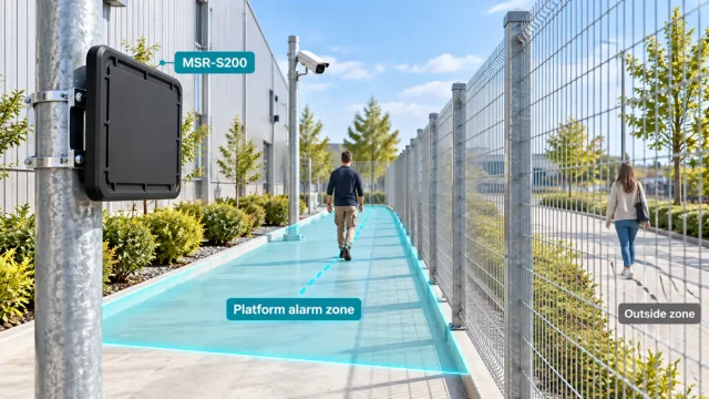
Not necessarily. A ground-surveillance radar may be optimized for people or vehicles near the surface, while a drone radar must monitor a three-dimensional airspace and process small airborne targets. The two systems may share underlying radar principles but require different coverage, processing and validation.
Conclusion
Drone radar systems can provide continuous detection and target-level tracking without depending on the aircraft’s communication link. Their effectiveness, however, depends on much more than nominal range.
Small radar cross section, hovering flight, birds, ground clutter, multipath and physical obstructions all affect performance. A reliable solution therefore requires suitable radar processing, realistic site surveys, carefully planned coverage, sensor fusion and field testing.
Organizations should also maintain a clear distinction between detection and mitigation. Radar can provide valuable situational awareness, but classification, threat assessment and response remain part of a broader security process.