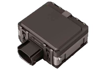
Radar and LiDAR are both non-contact sensing technologies used to detect vehicles, measure movement and support intelligent transportation systems. Although both can estimate an object’s distance and position, they use different parts of the electromagnetic spectrum and produce different types of data.
Radar uses radio waves. LiDAR uses laser light. This basic difference influences how the sensors measure speed, represent objects, respond to weather and integrate with traffic management systems.
For traffic engineers and system integrators, the question is not simply whether radar or LiDAR is more advanced. The correct choice depends on the required detection range, speed accuracy, spatial detail, environmental conditions, installation position and output interface.
This guide compares radar vs LiDAR specifically for roadside traffic monitoring, speed measurement and multi-lane vehicle detection.
What Is Radar?
Radar stands for radio detection and ranging. A radar sensor transmits radio-frequency energy and receives signals reflected from vehicles and other objects.
Traffic radar may use different modulation and antenna designs. Modern multi-target systems often use frequency-modulated continuous-wave technology, commonly known as FMCW radar.
Depending on its design, radar can estimate:
- Target distance
- Radial velocity
- Horizontal angle
- Travel direction
- Lane position
- Target trajectory
- Vehicle presence
- Traffic statistics
Distance is obtained from the characteristics of the returned signal. Velocity can be measured from Doppler information, while angle is estimated through the relationship between signals received by multiple antenna elements.
This ability to measure velocity directly is one of radar’s most important advantages in traffic applications.
For a more detailed introduction, see our guide to radar sensors, outputs and applications.
What Is LiDAR?
LiDAR stands for light detection and ranging. It transmits pulses or modulated beams of laser light and measures the returned light after it reflects from an object.
By scanning the environment, a LiDAR sensor can generate a collection of three-dimensional measurement points known as a point cloud. The point cloud describes the visible surfaces of vehicles, pedestrians, roadside structures and other objects.
LiDAR can provide:
- Object distance
- Horizontal and vertical position
- Object contour
- Height and width information
- Lane position
- Target trajectory
- Vehicle classification features
- Three-dimensional spatial information
Unlike radar, LiDAR does not normally obtain vehicle velocity directly from the Doppler effect. Most traffic LiDAR systems estimate velocity by comparing the target’s position across consecutive scans.
LiDAR’s detailed spatial output makes it useful when target shape, contour and precise position are more important than direct velocity measurement.
Radar vs LiDAR: The Fundamental Difference
The primary difference is the type of energy used.
Radar transmits radio waves with wavelengths considerably longer than visible or near-infrared light. LiDAR uses much shorter optical wavelengths.
Longer radio wavelengths generally provide radar with stronger environmental resilience but less geometric detail. Short optical wavelengths allow LiDAR to produce denser spatial information but make the optical path and exposed lens more important.
This does not mean that every radar performs well in every weather condition or that every LiDAR provides the same level of detail. Actual performance depends on wavelength, bandwidth, antenna or optical design, processing algorithms, transmitted power, mounting position and target characteristics.
Radar vs LiDAR Comparison
| Factor | Radar | LiDAR |
|---|---|---|
| Transmitted energy | Radio waves | Laser light |
| Typical raw output | Range, Doppler velocity, angle and signal strength | Distance measurements and point cloud |
| Speed measurement | Direct Doppler measurement or target tracking | Normally calculated from position changes |
| Spatial detail | Depends on bandwidth and antenna aperture | Generally provides detailed object contours |
| Lighting dependence | Does not require visible light | Does not require daylight but needs a clear optical path |
| Weather sensitivity | Generally resilient, although heavy precipitation and multipath can affect performance | Fog, rain, snow, spray and dirty optics may reduce usable returns |
| Stationary target detection | Supported by appropriate FMCW and tracking designs | Supported through repeated range measurements |
| Multi-lane tracking | Supported by multi-target traffic radar | Supported when field of view and point density are sufficient |
| Vehicle classification | Based on track, dimensions, motion and reflection features | Strong geometric classification potential |
| Maintenance | Usually limited optical maintenance | Exposed windows may require inspection and cleaning |
| Privacy characteristics | Does not produce a conventional visual image | Produces spatial point-cloud data rather than a conventional photograph |
| Typical traffic strength | Speed, long-range tracking and continuous flow measurement | Detailed geometry, contour and precise spatial representation |
The table describes general characteristics. It should not be used as a substitute for evaluating a specific sensor under the intended installation conditions.
Measurement Range
Both radar and LiDAR can provide long-distance detection, but quoted maximum range does not tell the complete story.
A useful traffic detection range depends on:
- Vehicle size and orientation
- Required measurement accuracy
- Mounting height
- Road curvature and gradient
- Number of lanes
- Traffic density
- Weather and roadside interference
- Minimum required update rate
Radar range is influenced by transmitted power, antenna gain, target reflectivity and signal processing. Large vehicles normally produce stronger radar reflections than small or low-reflectivity targets.
LiDAR range depends on optical power, receiver sensitivity, atmospheric visibility and target reflectivity. Dark surfaces, fog, water spray and contamination on the optical window can reduce the number of usable points.
System integrators should therefore evaluate effective range for the required data output, not only the longest distance at which a target can occasionally be detected.
Vehicle Speed Measurement
Radar has a natural advantage when speed is a primary measurement.
The Doppler shift of the reflected radio signal provides information about radial velocity. FMCW radar can combine distance and velocity measurements to separate and track multiple vehicles.
LiDAR commonly estimates speed by measuring how the target position changes over time. This can produce accurate results when the target is continuously tracked and the scan timing and geometry are well controlled.
The main practical difference is that radar receives velocity information directly from the returned signal, while LiDAR usually derives velocity from a sequence of position measurements.
For a detailed explanation of radar speed measurement, see how radar speed guns measure vehicle speed.
Range, Angle and Spatial Resolution
Resolution describes whether a sensor can distinguish two nearby targets. It should not be confused with accuracy.
Radar resolution includes:
- Range resolution
- Velocity resolution
- Angular resolution
Range resolution is influenced primarily by signal bandwidth. Velocity resolution is influenced by observation time and signal processing. Angular resolution depends on antenna aperture, array configuration and processing methods.
LiDAR resolution is commonly described through angular spacing, scan pattern, point density and distance accuracy. A dense point cloud can describe vehicle contours and separation between nearby objects in detail.
LiDAR often provides richer geometric information. Radar can provide strong separation in velocity even when two targets are relatively close in position.
These characteristics make the technologies complementary rather than directly interchangeable.
Performance in Rain, Fog and Poor Visibility
Radar does not rely on visible light and generally performs consistently across day, night and changing illumination. Rain and fog often have less effect on traffic radar than on optical sensors, although extremely heavy precipitation, road spray and reflections from surrounding structures can still influence detection.
LiDAR also operates independently of daylight because it supplies its own laser illumination. However, fog, rain, snow and airborne particles can scatter or attenuate laser light. Water or dirt on the optical window may also reduce the quality of the point cloud.
The appropriate conclusion is not that radar is unaffected by weather. It is that radar and LiDAR respond differently to environmental conditions, and the installation should be validated under representative weather and traffic scenarios.
Vehicle Classification
LiDAR can describe the visible three-dimensional contour of a vehicle. This makes it useful for distinguishing vehicle size and shape when sufficient point density is available.
Radar classification relies on a different combination of information, including:
- Target dimensions
- Speed and trajectory
- Radar reflection strength
- Motion characteristics
- Multiple reflection points
- Lane and direction information
Classification performance is product-specific. A statement that a sensor detects vehicles does not automatically mean it can reliably classify every vehicle type.
Projects requiring detailed classification should request the supported classes, confusion matrix, test conditions and handling of partially occluded vehicles.
Multi-Lane Vehicle Tracking
Radar and LiDAR can both support multi-lane tracking, but performance depends heavily on installation geometry.
Important factors include:
- Sensor mounting height
- Horizontal and vertical field of view
- Lane width
- Number of lanes
- Central barriers
- Road curvature
- Large-vehicle occlusion
- Stop-and-go traffic
- Target update rate
Radar tracking associates range, velocity and angle measurements across time. LiDAR tracking associates point clusters or detected objects across successive scans.
For multi-lane highways, radar is frequently selected when individual vehicle speed and long-range trajectories are important. LiDAR may be preferred where detailed object geometry is required within a defined monitoring area.
Learn more about vehicle tracking and lane-level outputs in our guide to radar traffic detectors.
Traffic Flow Monitoring
Traffic flow monitoring normally requires more than detecting individual vehicles. The system must convert target observations into statistics such as:
- Vehicle volume
- Average speed
- Lane occupancy
- Time headway
- Vehicle gap
- Queue length
- Classification totals
- Travel direction
Radar can generate these statistics from vehicle tracks and lane-crossing events. LiDAR can produce similar measurements by tracking point-cloud objects through configured detection zones.
The quality of the final traffic statistics depends not only on the sensing technology but also on lane calibration, tracking logic, aggregation intervals and handling of occlusion.
Our traffic flow sensors selection guide compares radar, LiDAR, loops, cameras and other detector technologies.
Speed Enforcement and Measurement-Line Applications
Speed enforcement requires accurate association between the measured speed, target position, measurement event and captured vehicle.
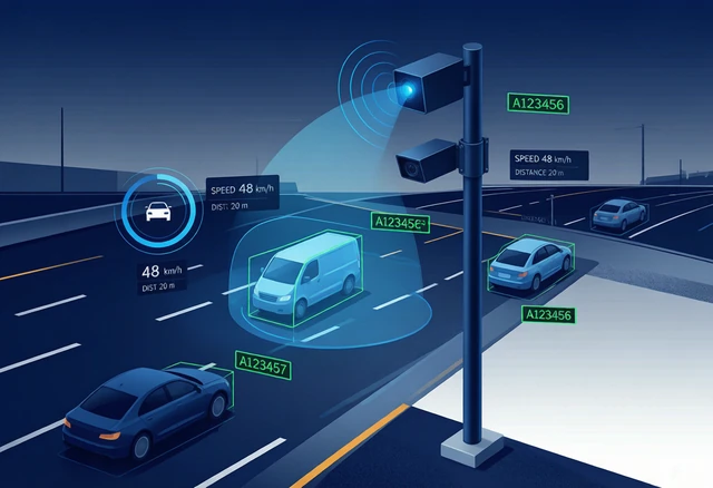
Radar is commonly used because it can directly measure vehicle velocity and track several targets across multiple lanes. The radar output can be associated with a virtual measurement line or trigger position used by a camera or enforcement controller.
LiDAR is also used for speed measurement, particularly where a narrow beam or precise aiming point is required. Handheld laser speed devices are an established example, although roadside multi-target enforcement systems have different tracking and integration requirements.
The complete system must prevent speed data from being assigned to the wrong vehicle. This requires time synchronisation, lane association, target tracking and camera calibration—not merely an accurate sensor.
Intersection Monitoring
Intersections contain crossing trajectories, turning vehicles, pedestrians, bicycles and frequent occlusion.
LiDAR can provide detailed spatial information within a defined intersection area. Radar can provide velocity and trajectory information across poor lighting and changing environmental conditions.
The preferred technology depends on the required targets and decisions:
- Vehicle presence for signal actuation
- Queue length
- Turning movement count
- Pedestrian detection
- Conflict analysis
- Red-light enforcement support
- Wrong-way or stopped-vehicle alarms
Complex intersections may use radar-video or radar-LiDAR fusion to combine complementary measurements.
Installation and Maintenance
Radar and LiDAR are both over-roadway or roadside technologies, so neither necessarily requires pavement cutting. However, their installation requirements differ.
Radar installation considerations
- Clear view of monitored lanes
- Correct azimuth and elevation angle
- Avoidance of strong reflective structures
- Stable mounting to prevent movement
- Suitable separation from other radar equipment
- Accurate lane and measurement-zone configuration
LiDAR installation considerations
- Clear optical line of sight
- Correct scan coverage and mounting angle
- Management of foreground occlusion
- Protection from dirt, water and physical contamination
- Access for cleaning and maintenance
- Eye-safety compliance and product certification
A sensor that performs well in an open test area may behave differently near signs, gantries, barriers, tunnels or closely spaced lanes. A site survey should precede installation.
Data Interfaces and System Integration
Sensor selection should include an evaluation of the output interface, not only detection performance.
Confirm the following before procurement:
- Ethernet, serial or RS485 interfaces
- Supported protocols
- Target-level data availability
- Traffic statistics format
- Coordinate system
- Timestamp and synchronisation method
- Update rate
- Remote configuration
- Diagnostics and health monitoring
- API or protocol documentation
Radar may output target coordinates, velocity, direction and track identifiers. LiDAR may output raw point clouds, clustered objects or processed traffic events.
Raw point clouds require substantially different processing and network resources from a compact radar target list. The system architecture must account for bandwidth, edge processing and storage requirements.
When Should You Choose Radar?
Radar is generally the stronger choice when the project prioritises:
- Direct vehicle speed measurement
- Long-range detection
- Multi-lane tracking
- Operation across day and night
- Reduced dependence on optical visibility
- Compact target-level data
- Low optical maintenance
- Traffic statistics derived from continuous tracking
A long-range traffic radar such as the HC-M250 can provide target data for multi-lane traffic monitoring and integration with existing traffic platforms.
When Should You Choose LiDAR?
LiDAR may be preferred when the project requires:
- Detailed object contours
- Height and three-dimensional geometry
- Dense spatial representation
- Precise separation within a defined area
- Classification based on physical shape
- Mapping of complex intersection zones
- Optical sensing without radio-frequency emissions
The final decision should be based on actual test data for the intended road geometry and environment.
When Is Sensor Fusion Appropriate?
Radar and LiDAR can be combined because their strengths are different.
Radar contributes direct velocity measurement and environmental resilience. LiDAR contributes detailed geometry and object contours. A fusion algorithm can associate observations from both sensors to produce a more complete target representation.
However, fusion also introduces additional requirements:
- Coordinate calibration
- Time synchronisation
- Target association
- Network bandwidth
- Processing capacity
- Fault handling
- Maintenance of two sensor types
Fusion is valuable only when the additional information supports a defined system function. Adding sensors without a clear data requirement can increase complexity without improving the final traffic decision.
Frequently Asked Questions
Is radar better than LiDAR?
Neither technology is universally better. Radar is often stronger for speed measurement, long-range tracking and operation in changing visibility. LiDAR often provides more detailed spatial and shape information.
Can radar detect stationary vehicles?
FMCW and other presence-detecting radar designs can detect stationary vehicles. A simple continuous-wave Doppler speed sensor may not detect a stationary target because there is no Doppler shift.
Can LiDAR measure vehicle speed?
Yes. LiDAR generally measures speed by tracking changes in target position over time. The measurement method differs from radar’s direct use of Doppler information.
Does LiDAR work at night?
Yes. LiDAR transmits its own laser light and does not depend on daylight. Its optical path can still be affected by fog, rain, snow, spray or contamination.
Does radar produce a photograph?
No. Traffic radar normally outputs detections, coordinates, speed, direction and tracks rather than a conventional visible-light image.
Which technology is better for traffic flow monitoring?
Radar is often selected for long-range multi-lane speed and trajectory data. LiDAR can be advantageous when detailed contours and spatial geometry are required. The correct choice depends on the project’s required output and environment.
Can radar and LiDAR replace cameras?
They can perform vehicle detection and tracking without conventional images, but they do not provide all the visual evidence available from a camera. Many systems combine radar or LiDAR with video when visual verification is required.
Conclusion
Radar and LiDAR both support non-contact vehicle detection, traffic flow monitoring and intelligent transportation applications, but they solve the measurement problem in different ways.
Radar uses radio waves and provides strong velocity information, long-range tracking and operation independent of visible light. LiDAR uses laser light and produces detailed spatial information that can support contour-based classification and complex scene analysis.
The best technology is the one whose measurable outputs match the application. System integrators should compare effective detection range, speed measurement method, resolution, weather performance, installation geometry, output format and lifecycle maintenance before choosing a sensor.
Where speed, multi-lane tracking and continuous traffic data are the priorities, radar is often the practical choice. Where detailed three-dimensional geometry is essential, LiDAR may provide additional value. In demanding applications, carefully designed sensor fusion can combine both.