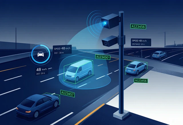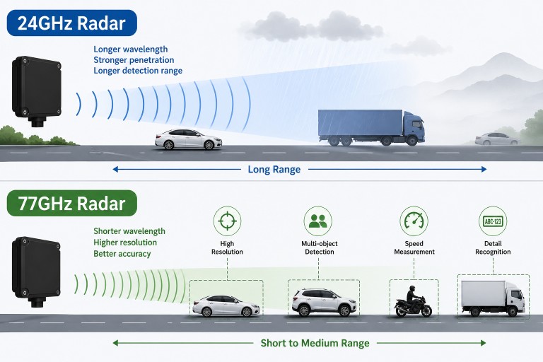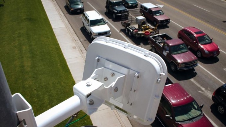
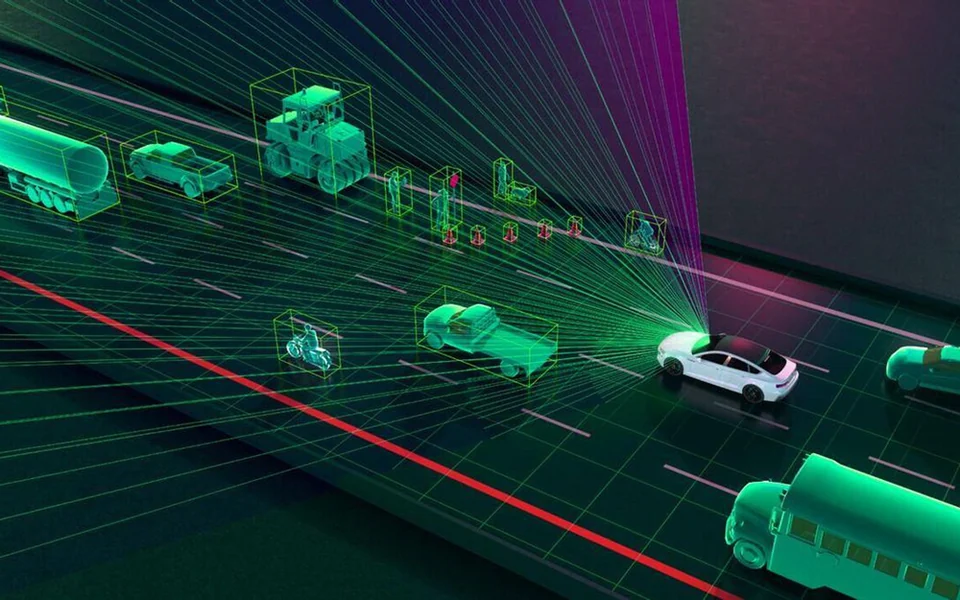
A 3D radar determines where a target is located in three-dimensional space by measuring its range, azimuth and elevation. Depending on the waveform and signal-processing design, it may also measure radial velocity and maintain tracks for multiple moving or stationary objects.
The term “3D radar” is frequently used in traffic sensing, automotive systems, air surveillance and perimeter security. However, product terminology is not always consistent. Some suppliers use “3D” to describe three spatial coordinates, while others use it more loosely for radar point clouds or target tracking.
For this reason, buyers should examine the radar’s actual output fields and measurement performance rather than relying on the dimension stated in its name.
What Is 3D Radar?
In the conventional radar definition, a 3D radar measures:
- Range: the distance from the radar to the target.
- Azimuth: the horizontal angle of the target relative to the radar.
- Elevation: the vertical angle of the target relative to the radar.
These measurements locate a target in a three-dimensional coordinate system. The radar or an external processor can convert the spherical measurements into Cartesian coordinates such as X, Y and Z.
Velocity is often available as an additional measurement because many radar systems calculate Doppler shift. However, the label “3D radar” alone does not guarantee velocity output, multiple-target tracking, classification or imaging capability.
How Does 3D Radar Work?
A 3D radar transmits radio-frequency energy into a defined field of view and receives signals reflected by objects. The signal processor extracts several measurements from the returned signal.
Range measurement
Range can be obtained from signal travel time or, in an FMCW radar, from the frequency difference between transmitted and received chirps. Range resolution depends on factors such as signal bandwidth and processing design.
Velocity measurement
Movement changes the frequency or phase of the returned radar signal. Doppler processing uses this change to estimate radial velocity—the component of target speed toward or away from the radar.
Radial velocity is not necessarily the same as total ground speed. Measurement geometry must be considered when the target moves at an angle to the radar beam.
Azimuth measurement
Azimuth indicates the target’s horizontal direction. Radar systems may estimate it using beam steering, multiple receive channels or phase and amplitude differences across an antenna array.
Elevation measurement
Elevation indicates the target’s vertical direction. Measuring elevation requires antenna aperture and processing in the vertical dimension. A radar with only horizontal angular channels cannot obtain true elevation merely through software.
Target tracking
After detecting objects, tracking software can associate detections across consecutive measurement cycles. A track may contain a target ID, position, velocity, direction and confidence information.
Tracking helps suppress intermittent detections and predict target movement, but performance depends on update rate, resolution, target density, occlusion and the tracking algorithm.
2D vs 3D vs 4D Radar
| Term | Commonly described measurements | Important qualification |
|---|---|---|
| 2D radar | Range and azimuth | May also measure Doppler velocity even though it is called 2D |
| 3D radar | Range, azimuth and elevation | Does not automatically mean high-resolution imaging or classification |
| 4D radar | Range, azimuth, elevation and radial velocity | An industry term whose meaning can vary between manufacturers |
The table describes common usage, not a universal naming standard. Radar has measured Doppler velocity for decades, including systems that are called 2D or 3D. In automotive and industrial markets, “4D imaging radar” generally refers to radar that combines range, azimuth, elevation and Doppler velocity with higher angular resolution and a denser output.
A procurement specification should therefore state the required measurements, resolution, accuracy, update rate and output format instead of requesting only a “3D” or “4D” radar.
For additional discussion of the newer terminology, see What Is 4D Radar?.
Does 3D Radar Produce a 3D Image?
Not necessarily. A target list containing range, azimuth and elevation is three-dimensional data, but it may contain only one point or track per detected object.
An imaging radar normally provides a denser set of detections and improved angular resolution. This may create a point-cloud-like representation of the environment, but its appearance and information density differ from a camera image or lidar point cloud.
Before describing a radar as an imaging system, verify:
- Range resolution
- Azimuth resolution
- Elevation resolution
- Number of simultaneous detections or tracks
- Field of view
- Update rate
- Raw point-cloud or processed target-list output
How Does a Radar Measure Elevation?
Elevation measurement requires the radar to distinguish signals arriving from different vertical angles. This is normally achieved using multiple antenna elements arranged with a vertical aperture.
The processor compares the phase or amplitude of received signals across these channels. Beamforming or direction-of-arrival processing then estimates the elevation angle.
MIMO radar can create a larger virtual antenna array by combining multiple transmitting and receiving elements. This can improve angular resolution without requiring a separate physical antenna for every virtual channel. Actual performance still depends on array geometry, signal-to-noise ratio, calibration and processing.
3D Radar in Traffic Applications
Many ordinary traffic-monitoring projects need range, horizontal position and speed rather than elevation. A correctly designed 2D tracking radar may therefore be sufficient for lane-level vehicle monitoring.
Elevation becomes more useful when the system must separate objects at different heights or operate in complex three-dimensional geometry.
Overhead and multilayer road structures
Interchanges, elevated roads, bridges and access ramps can place targets at different heights. Elevation data can help distinguish traffic occupying different physical levels, provided the radar has sufficient elevation resolution.
Vehicle-height and object-position analysis
A 3D radar may contribute height-related information, but it should not automatically be treated as an accurate vehicle dimensioning system. Antenna resolution, mounting geometry and reflection points affect the apparent target height.
Complex intersections
Elevation information can help suppress detections from overhead structures or separate relevant road users from background reflections. The practical benefit depends on the installation position and road geometry.
Radar-camera fusion
Three-dimensional coordinates can support projection of radar targets into a camera image. Reliable fusion still requires accurate spatial calibration, time synchronisation and coordinate transformation.
For projects focused on vehicle count, speed, occupancy and trajectories, see the traffic flow monitoring solution.
3D Radar in Security Applications
Perimeter monitoring
A security radar can detect and track people or vehicles moving through a monitored area. Elevation information may help separate ground targets from objects above the terrain or reduce detections outside the required vertical region.
Drone detection
Elevation is important when tracking airborne targets. However, detecting a small drone also depends on radar cross-section, range, clutter, update rate and target-processing performance. A radar should not be selected for drone detection based only on its 3D designation.
Critical infrastructure
At airports, ports, power facilities and other complex sites, three-dimensional coordinates can help operators understand where a target is relative to fences, buildings and restricted zones.
Radar-camera positioning
Azimuth and elevation measurements can help direct a pan-tilt-zoom camera toward a radar track. The coordinate systems must be calibrated, and the camera should account for mechanical movement and response delay.
For a ground-surveillance example, see the perimeter security radar solution.
What 3D Radar Does Not Guarantee
The term “3D radar” does not by itself guarantee:
- Accurate object classification
- A dense radar image
- Detection through every obstruction
- Unlimited simultaneous targets
- High elevation resolution
- Precise physical target dimensions
- Freedom from weather or environmental effects
- Reliable performance without site calibration
For example, the radar may measure an elevation angle but have insufficient resolution to distinguish two vertically adjacent targets. Similarly, a product may output a large number of detections but have limited track continuity in dense traffic.
Factors That Affect 3D Radar Performance
Angular resolution
Azimuth and elevation accuracy are not the same as angular resolution. Accuracy describes how close a reported angle is to the reference value. Resolution describes whether two nearby targets can be separated.
Antenna aperture
A larger effective aperture generally supports finer angular resolution. Physical size, antenna layout, wavelength and MIMO configuration all influence the result.
Signal bandwidth
Bandwidth affects range resolution. Two targets at similar distances may merge into one detection if the radar cannot resolve them in range or angle.
Mounting geometry
Mounting height, tilt, lateral offset and field of view determine which parts of the environment are visible. Coordinate accuracy also depends on correct installation measurements.
Occlusion
A large object can block a smaller target behind it. Three-dimensional measurement does not eliminate line-of-sight limitations.
Multipath and clutter
Ground surfaces, walls, guardrails and metal structures can create additional reflection paths. Clutter filtering and exclusion zones must be validated at the actual site.
Target density and update rate
Dense scenes require sufficient detection capacity and tracking performance. A high update rate can improve track continuity, but update rate alone does not determine measurement quality.
How to Select a 3D Radar
Define the required data before comparing products.
- Required coordinates: confirm whether elevation or Z-coordinate output is actually necessary.
- Detection range: specify minimum and maximum operating distance for representative targets.
- Field of view: define horizontal and vertical coverage.
- Resolution: distinguish range, azimuth and elevation resolution from measurement accuracy.
- Target capacity: define expected simultaneous detections and tracks.
- Velocity output: confirm radial velocity, direction and any ground-speed calculation.
- Stationary targets: verify whether stopped objects remain detectable and tracked.
- Output level: choose between raw detections, point clouds, target lists, zones or events.
- Interfaces: confirm Ethernet, serial, CAN or other required communications.
- Environment: evaluate mounting, enclosure, temperature, precipitation and electromagnetic conditions.
- Integration: define coordinate origin, timestamps, target IDs and status messages.
- Validation: agree on field acceptance tests before installation.
How to Validate a 3D Radar Installation
Commissioning should test each required measurement independently. A practical test may include:
- Range at several known positions
- Azimuth across the full horizontal field of view
- Elevation at representative target heights
- Velocity against a suitable reference
- Two-target separation in range and angle
- Tracking continuity across the monitored area
- Stationary and moving targets
- Representative target sizes
- Occlusion and dense-scene behaviour
- Coordinate conversion into the external system
- Recovery after power or communication interruption
Do not reduce these results to one general accuracy percentage. Range accuracy, angular accuracy, resolution, detection probability and tracking continuity are different performance measures.
Frequently Asked Questions
What are the three dimensions in 3D radar?
They are normally range, azimuth and elevation. These measurements locate a target relative to the radar in three-dimensional space.
Does 3D radar measure speed?
Many 3D radar systems also measure radial velocity using Doppler processing, but speed is not guaranteed by the 3D label alone. Check the actual product output.
What is the difference between 2D and 3D radar?
A conventional 2D radar provides range and azimuth. A 3D radar adds elevation. Both may also measure Doppler velocity.
What is the difference between 3D and 4D radar?
In common industry terminology, 4D radar provides range, azimuth, elevation and radial velocity, often with higher angular resolution. Because 3D radar can also measure velocity, buyers should verify the manufacturer’s exact definition.
Is 3D radar the same as imaging radar?
No. A 3D target coordinate does not necessarily form a detailed image. Imaging radar normally implies denser detections and higher spatial resolution.
Can 3D radar classify vehicles and pedestrians?
Some systems provide classification based on motion, reflection characteristics or track features. Classification performance must be validated separately and should not be assumed from the radar’s dimensional label.
Does every traffic project need 3D radar?
No. Many traffic applications require horizontal position, range and speed only. Elevation should be specified when it provides a measurable benefit for the actual road geometry or integration task.
Summary
A 3D radar measures target range, azimuth and elevation to determine position in three-dimensional space. Many systems also provide Doppler velocity and multiple-target tracking, but these functions must be confirmed from the technical specification.
The terms 2D, 3D and 4D radar are useful starting points, not complete product definitions. The correct selection depends on resolution, field of view, target capacity, update rate, output format and verified performance in the intended environment.
For procurement and system integration, specify the measurements the application requires and define separate acceptance tests for position, velocity, resolution and tracking.