4D radar measures target range, Doppler velocity, azimuth and elevation. Together, these measurements allow a system to locate objects in three-dimensional space while also observing their radial motion.
The term is commonly associated with high-resolution automotive and industrial imaging radar. However, “4D” does not automatically mean that a radar produces a detailed image, classifies every object or matches lidar spatial resolution.
Buyers should examine the radar’s actual angular resolution, detection capacity, output format and verified performance rather than relying on the 4D label alone.
What Is 4D Radar?
In common industry terminology, the four radar dimensions are:
- Range: distance from the radar to the target.
- Azimuth: horizontal target angle.
- Elevation: vertical target angle.
- Doppler velocity: target speed toward or away from the radar.
Range, azimuth and elevation define a three-dimensional target position. Doppler adds radial motion information.
Some articles describe time as the fourth dimension. Radar tracking does observe targets over time, but in most automotive and industrial 4D radar specifications, the fourth measured quantity refers to Doppler velocity.
Why Is It Called Imaging Radar?
A conventional radar may output one detection or one processed track for each object. An imaging radar attempts to provide more detections across the visible parts of a target or scene.
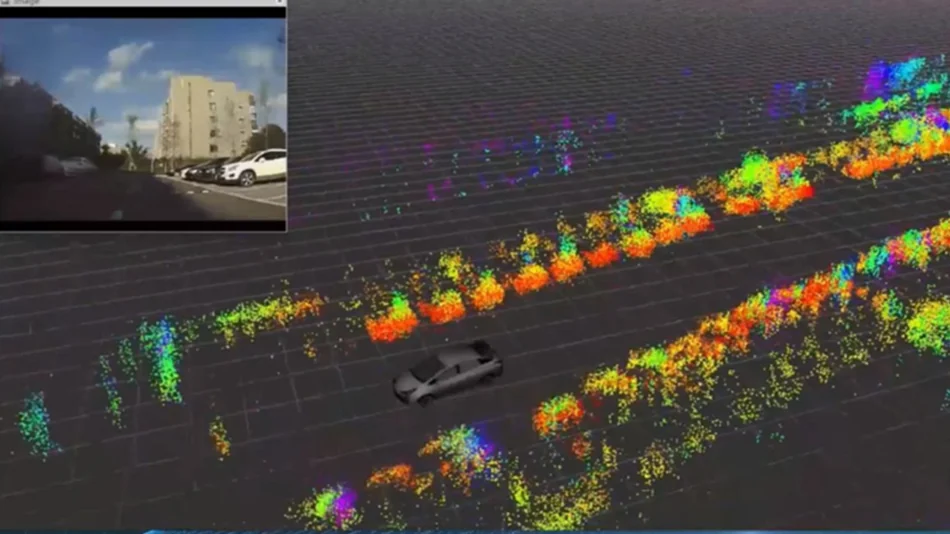
Higher range and angular resolution can generate a denser representation that resembles a point cloud. This can reveal more spatial structure than a basic target list.
However, radar point clouds are normally sparser and noisier than lidar point clouds. “Imaging” should therefore be evaluated using measurable specifications rather than assumed to mean photographic or lidar-like detail.
How Does 4D Radar Work?
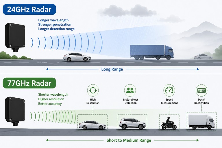
Many modern 4D radar systems use millimeter-wave FMCW signals, multiple transmitting and receiving antennas, digital beamforming and high-resolution signal processing.
Range measurement
An FMCW radar transmits frequency-changing chirps. The delay between the transmitted and reflected signal creates a beat frequency that is used to estimate target distance.
Range resolution depends mainly on swept bandwidth. It should not be confused with maximum detection range or range accuracy.
Doppler velocity
Movement produces a phase change across consecutive chirps. Doppler processing converts this change into radial velocity.
Radial velocity represents motion toward or away from the sensor. A target moving across the radar’s field of view may have a low radial velocity even when its actual ground speed is high.
Azimuth measurement
Horizontal direction is estimated from phase or amplitude differences across antenna elements arranged with a horizontal aperture.
Elevation measurement
Vertical direction requires antenna channels with a suitable vertical aperture. The processor uses these channels to estimate elevation angle.
A radar cannot obtain reliable elevation simply by adding software to an antenna system designed only for horizontal angle measurement.
MIMO and virtual arrays
Multiple-input multiple-output radar uses several transmitting and receiving antenna elements. Their combinations create a virtual antenna array that may be larger than the number of physical receive channels alone.
MIMO can improve angular measurement and target separation, but performance still depends on array geometry, channel calibration, waveform design and signal-to-noise ratio.
Detection and tracking
After processing range, Doppler and angle data, the radar may output raw detections, point clouds or processed tracks.
A tracked target may include:
- Target ID
- Range and radial velocity
- Azimuth and elevation
- X, Y and Z coordinates
- Direction of travel
- Track age and confidence
- Radar cross-section or signal-strength information
- Optional classification or event fields
The presence of a field in the output does not guarantee that it meets the accuracy or resolution required by the application.
2D vs 3D vs 4D Radar
| Common term | Typical measurements | Important limitation |
|---|---|---|
| 2D radar | Range and azimuth | May still measure Doppler velocity |
| 3D radar | Range, azimuth and elevation | May also measure velocity, so naming is not universal |
| 4D radar | Range, azimuth, elevation and Doppler velocity | Does not automatically mean high-resolution imaging |
| 4D imaging radar | Four-dimensional measurements with denser detections and higher angular resolution | Point-cloud density and resolution vary considerably by product |
The terminology is useful for general comparison but is not a complete specification. A conventional 3D radar may already provide Doppler velocity. In that case, the practical distinction between it and a product marketed as 4D radar may be angular resolution, point-cloud density or target capacity.
For the conventional definition of three-dimensional radar coordinates, see the 3D radar guide.
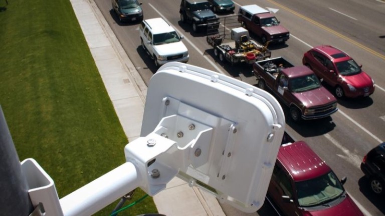
4D Radar vs Conventional Traffic Radar
A conventional traffic radar may already provide everything required for vehicle speed, lane assignment and trajectory tracking. Elevation and dense point-cloud output are not necessary for every road application.
4D radar is more relevant when the system must distinguish targets at different heights, represent object structure, separate closely spaced targets or operate in complex three-dimensional geometry.
Adding more output dimensions also increases processing, data-transfer and calibration requirements. The application should justify the additional complexity.
4D Radar vs Lidar
| Characteristic | 4D imaging radar | Lidar |
|---|---|---|
| Signal | Radio waves | Laser light |
| Direct radial velocity | Yes, using Doppler | Not inherent in every lidar; often derived through tracking |
| Point-cloud density | Generally sparser | Generally denser |
| Angular detail | Depends strongly on antenna aperture and processing | Often provides finer spatial detail |
| Lighting dependence | Does not require visible illumination | Also uses an active optical signal |
| Environmental sensitivity | Can be affected by precipitation, radome condition, clutter and multipath | Can be affected by fog, precipitation and optical-window contamination |
4D radar should not be described as a universal lidar replacement. The technologies provide different information and may be complementary.
4D Radar vs Camera
A camera provides detailed appearance information such as colour, markings, licence plates and visual object boundaries. Radar provides direct range and radial-velocity measurements without relying on visible road illumination.
Radar cannot replace visual evidence when an application requires plate recognition or a clear image of an incident. Cameras, meanwhile, may struggle with glare, shadows, darkness, fog or contamination.
In a fusion system, radar can provide position and velocity while the camera supplies visual classification. Reliable fusion requires accurate timestamps, coordinate calibration and target association.
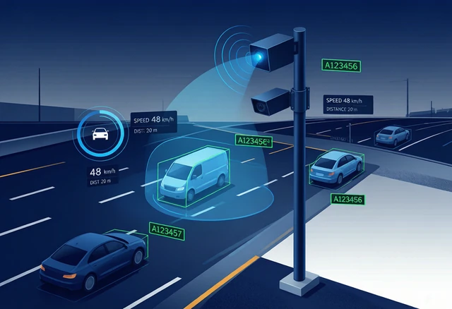
4D Radar in Traffic Monitoring
Multilane target tracking
Higher angular resolution may help separate vehicles travelling close together in adjacent lanes. Actual lane-assignment performance still depends on mounting geometry, traffic density and field calibration.
Complex road geometry
Elevation data can be useful around ramps, bridges, elevated roads or other locations where targets occupy different vertical levels.
Vehicle and vulnerable-road-user separation
Dense detections and motion features may support classification of vehicles, pedestrians and bicycles. Classification must be validated separately using representative targets and conditions.
Radar-camera association
Three-dimensional coordinates may improve projection of radar detections into a camera image. The radar and camera coordinate systems must be calibrated, and both devices must use compatible timing.
Traffic analytics
A tracking system can use target trajectories to calculate vehicle count, speed, occupancy and headway. A 4D radar is not automatically necessary for these statistics; a suitable traffic-tracking radar may already provide them.
For a system-level example, see the traffic flow monitoring solution.
4D Radar in Speed Enforcement
A 4D radar can provide speed, lane position and target coordinates for integration with an enforcement camera. Higher resolution may help distinguish overlapping vehicles, but dimensionality alone does not make a radar suitable for legal enforcement.
An enforcement system may also require:
- Approved speed accuracy
- Defined measurement and trigger locations
- Target-to-image association
- Time synchronisation
- An independent secondary check
- Calibration records
- Local type approval or certification
For integration requirements, see the speed enforcement solution.
4D Radar in Perimeter Security
Ground-target tracking
Range, angle and Doppler data can locate and track people or vehicles moving through a monitored area.
Elevation filtering
Elevation information may help separate ground targets from objects above or below the required surveillance region.
Radar-camera cueing
A three-dimensional radar track can direct a pan-tilt-zoom camera toward a target. Coordinate accuracy, camera response time and spatial calibration determine final pointing performance.
Airborne-target monitoring
Elevation is important for tracking drones or other airborne objects. Detection range depends strongly on target radar cross-section, orientation, clutter and waveform design.
A radar should not be specified for drone detection simply because it is described as 4D.
For ground-surveillance applications, see the perimeter security radar solution.
Can 4D Radar Identify Object Shape?
A high-resolution radar may produce several detections from different parts of one object. These detections can provide information about target extent and motion.
However, radar reflections depend on material, surface orientation and geometry. The strongest detections do not necessarily form a complete physical outline.
Object dimensions and classification should therefore be treated as processed estimates, not as guaranteed visual representations.
Does 4D Radar Work in All Weather?
Radar does not depend on visible illumination and often maintains useful operation in darkness, glare and common roadside weather.
It is not completely unaffected by the environment. Heavy precipitation, water or ice on the radome, multipath, ground clutter and installation geometry can reduce signal quality.
Environmental capability should be assessed through documented specifications and field tests rather than an unrestricted “all-weather” claim.
Limitations of 4D Imaging Radar
Sparse and noisy point clouds
Radar point clouds may contain fewer points and more position uncertainty than lidar data. Algorithms developed for lidar cannot always be transferred directly to radar.
Angular resolution
Fine angular resolution requires sufficient effective antenna aperture. High channel count alone does not guarantee performance if array geometry and calibration are unsuitable.
Channel calibration
Amplitude and phase differences between antenna channels must be controlled. Calibration errors can affect azimuth and elevation estimates.
Multipath
Road surfaces, buildings, fences and metal structures can create indirect reflection paths and apparent targets.
Occlusion
A large target can block a smaller target behind it. Adding elevation measurement does not eliminate line-of-sight limitations.
Processing and bandwidth
Denser detections and additional dimensions increase computation, memory and communication requirements. Integrators must decide whether to transmit raw detections, point clouds or processed tracks.
Interference
Nearby radar sensors can interfere when waveforms overlap. Mitigation depends on timing, waveform configuration, antenna orientation and processing.
Specifications to Compare
When evaluating a 4D radar, compare:
- Operating band and permitted regional use
- Range and range resolution
- Azimuth and elevation field of view
- Azimuth and elevation accuracy
- Azimuth and elevation resolution
- Velocity range and velocity resolution
- Detection and reliable tracking range by target type
- Maximum detections and simultaneous tracks
- Update rate and latency
- Stationary-target behaviour
- Point-cloud and target-list output
- Coordinate system and timestamp format
- Interfaces and integration documentation
- Environmental and enclosure specifications
How to Validate a 4D Radar
A field-acceptance plan should verify each required measurement separately.
- Test range at known positions.
- Test azimuth throughout the horizontal field of view.
- Test elevation using targets at representative heights.
- Compare velocity with a suitable reference.
- Test two-target separation in range and angle.
- Measure track continuity during crossing and overtaking.
- Test stationary and slow-moving targets when required.
- Test representative cars, trucks, motorcycles, bicycles and pedestrians.
- Evaluate dense traffic or crowded scenes.
- Verify coordinate transformation into the external system.
- Test communication interruption and recovery.
Avoid reporting one combined accuracy percentage. Detection probability, range accuracy, angular accuracy, resolution and tracking continuity are different measures.
Frequently Asked Questions
What are the four dimensions of 4D radar?
They are commonly range, Doppler velocity, azimuth and elevation.
Is time the fourth dimension?
Tracking occurs over time, but commercial automotive and industrial 4D radar normally uses Doppler velocity as the fourth measured dimension.
Is every 4D radar an imaging radar?
No. A radar may output four target measurements without producing a dense, high-resolution point cloud. Imaging capability depends on resolution, aperture and processing.
Is 4D radar better than 3D radar?
Not for every application. A conventional radar may already provide the required speed, range and horizontal position. Elevation or denser imaging is useful only when the application needs it.
Can 4D radar replace lidar?
Not universally. Radar provides direct Doppler velocity and strong operation across changing light conditions, while lidar generally provides denser spatial detail. Many systems use both.
Can 4D radar classify objects?
Some systems provide classification using spatial, motion and reflection features. Accuracy varies by product and scene and must be validated separately.
Is mmWave radar automatically 4D?
No. “mmWave” describes the frequency region. A millimeter-wave sensor may output only motion, range, 2D position, 3D position or full four-dimensional data. See the mmWave sensor guide.
Summary
4D radar combines range, Doppler velocity, azimuth and elevation to locate targets in three-dimensional space and observe their radial motion.
High-resolution imaging radar can provide denser spatial information than conventional radar, but it does not automatically match lidar detail, classify every object or operate without environmental effects.
The correct selection depends on measurable performance: range, angular resolution, target capacity, update rate, output format and verified operation in the intended environment.